Satellite
FORECAST SOL: Moderate yellow MAG: Moderate yellow ION: Normal green
HomeSatelliteTotal Electron ContentTEC Global Map Saturday, Jan 17 2026 19:43 UT
Total Electron Content

TEC Global Map

Updates: Every 15 minutes
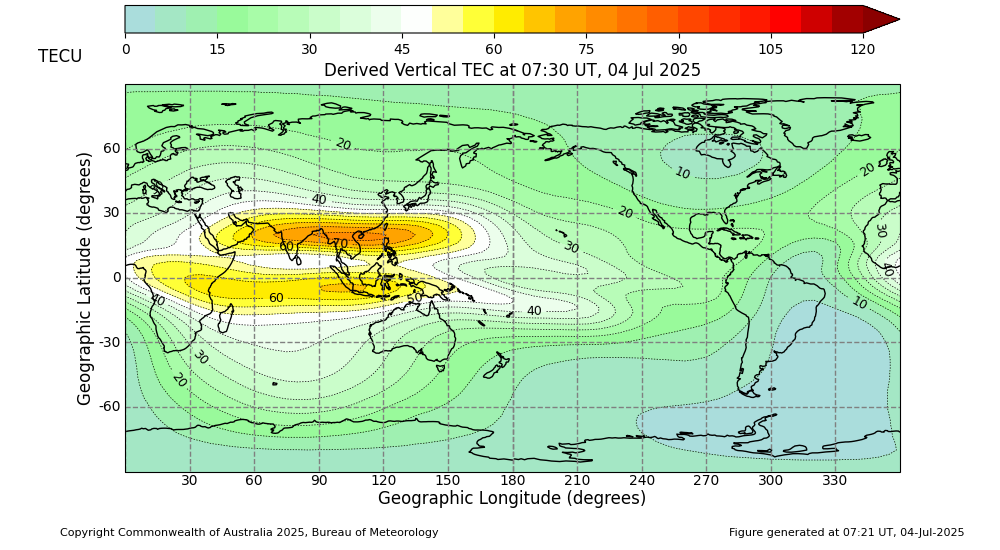
 Total Electron Content Map

This map is produced by the Australian Space Weather Forecasting Centre (ASWFC) using the International Reference Ionosphere (IRI-2020) model. It shows vertical Total Electron Content (VTEC) and the range error (in metres) for GPS L1 signals, which operate at 1575.42 MHz. One TEC unit (TECU) equals 1016 electrons per square metre. The GPS L1 range error is directly proportional to the amount of TEC along the signal's path.

You can access TEC images and data files from the past 24 hours here. The IRI model is run every 30 minutes and uses near real-time inputs including: Daily F10.7 solar flux, sunspot numbers, estimated Ap index and three-hourly ap indices. In these simulations, the foF2 STORM model option within IRI-2020 is turned on. All other settings use the model's default values and no data assimilation has been applied.

go to top of page