Updates: Every 10 minutes

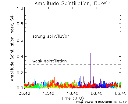
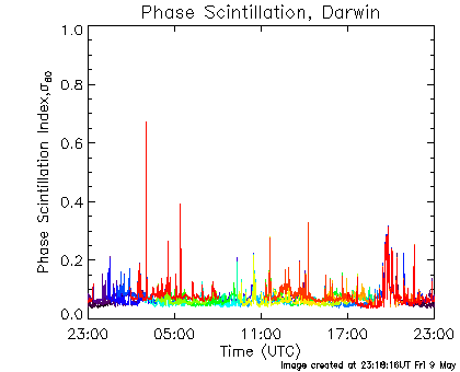

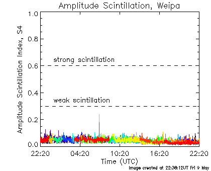
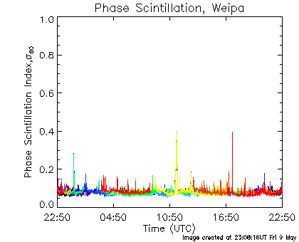


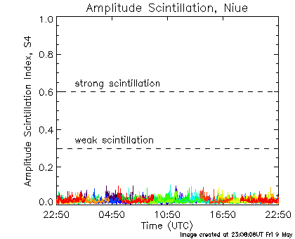

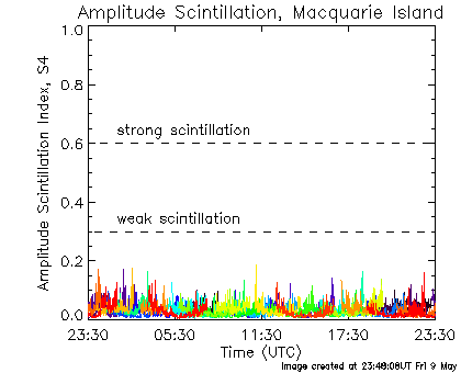
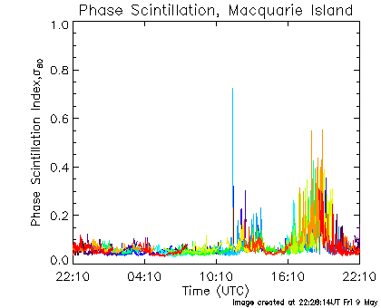
The graphs on this page show ionospheric Scintillation indices over the last 24 hours, as measured by ASWFC Ionospheric Scintillation Monitor (ISM) sites. In each graph, the signal from each of the 31 active GPS satellites is shown with a different colour.
Graphs in the left hand column display amplitude scintillation, a measure of the short timescale fluctuation in the signal to noise. This is quantified by the S4 index. Values over ~0.6 indicate strong scintillation which can cause loss of lock on a GPS signal. A scintillation index below 0.3 is unlikely to have any affect on GPS. Amplitude scintillation seen in the Darwin and Weipa scintillation monitors is commonly due to an ionospheric phenomena called "plasma bubbles".
Graphs in the right hand column show phase scintillation, a measure of the short timescale fluctuation in the phase of the GPS signal. This is quantified by σ60, the standard deviation of the signal phase in radians, over 60 second intervals. Phase scintillation seen in the Macquarie Island scintillation monitor is generally a sign of auroral activity.
For more general information on ionospheric scintillation, please visit the About Ionospheric Scintillation page.
ASWFC provides a free email alert service for ionospheric scintillation, please visit the Ionospheric Scintillation Alert page to subscribe.
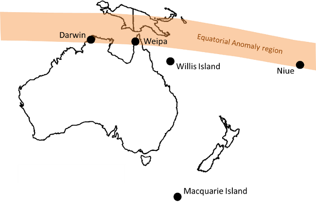
ASWFC operates a number of ISMs in the Australasian region, close to the southern equatorial anomaly, as well as in the sub-Antarctic region to the south of Australia. Locations of currently active ASWFC ISMs are indicated on the map below. Ionospheric Scintillation data from these instruments is available through the ASWFC World Data Centre.
Ionospheric scintillation products and services are under ongoing development, and your feedback is valuable to us. If you are experiencing problems with ionospheric scintillation in GPS receivers or satellite communications equipment, or have a suggestion on ways we may improve our scintillation-related services, please contact ASWFC.


